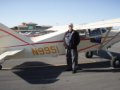
Planning a trip to Alaska this June . Leaving Georgia in my Maule ,looking for any information that someone may have already made trip before.
Any information will be appropriated.
Trip to alaska
-
Tommy
- Posts: 2
- Joined: Tue Dec 30, 2014 7:11 am
- Location: Thomaston georgia
- Contact:
Trip to alaska
God,country,duty ,God bless those who believe in all three!
-
rjb
- 100+ Posts
- Posts: 206
- Joined: Wed Aug 30, 2006 5:32 pm
- Location: e16
- Contact:
I suggest you figure a month to get there in order to get the full benefit of the trip. So far, I have avoided long trips without somebody else in the plane.
I haven't done Georgia to Alaska; but I have done Georgia to San Francisco Bay area, and San Francisco Bay to Tuktoyaktuk.
Using Yelp and tripadvisor on my Iphone have been great aids when trying to figure out what the night's destination should be in the states - make sure you switch service over the borders. I had a laptop to give me a big picture of weather.
Above the lower 48, I always carried enough fuel that I could get back to where I launched from without being too nervous.
To me, scattered thunderstorms in the mountains are much more threatening than over the plains or wide valleys.
I rented an Iridium satellite phone from Mobil.com. It cost me $13 a day to have.
At a minimum, you should have a PLB and I would recommend a 406 ELT and a SPOT or Delorme.
Although I only used it that one trip, I signed up for CANPASS: it opens up your Canada border crossing opportunities.
I entered at Boundary Bay and came back through Bellingham; both experiences where pleasant.
You should look through previous threads here and also the threads on backcountrypilot.org
You can't take too many pictures.
-
captnkirk
- 100+ Posts
- Posts: 942
- Joined: Wed Dec 25, 2013 4:54 pm
- Location: Cherryville NC
- Contact:
I second the Delorme I have the Inreach I carry it with me in the plane almost all the time. Besides the sos function I can send text messages to anyone with a cell phone you just have to load the info ahead of time into the website. Lockheed Martin can send sigmet and airmet updates as well as any tfr that popup on your route of flight so long as you file and activate a flight plan They offer a few different price plans now so call and set up what works for you. While it's not a sat phone the messaging can keep people informed of your where about. Also there is an app so you can use an Ipad to compose the messages. Any time I'm more than a few miles away I carry mine it gives the wife piece of mind knowing she's on the alert list.
Kirk Johnson
If god had meant man to fly he would have given him more money
If god had meant man to fly he would have given him more money
-
Danws
- 100+ Posts
- Posts: 156
- Joined: Fri Mar 29, 2013 6:56 pm
- Location: Roseburg Oregon
- Contact:
-
MrHRC
- Posts: 84
- Joined: Mon Jan 27, 2014 10:21 pm
- Location: Langley, BC
- Contact:
Trip to alaska
I live in Langley B.C. Vancouver area. If you need a local contact let me know. I could provide local airport info, accommodation, transportation, and or lunch/ dinner. Would be great to meet you on your adventure.
-
rjb
- 100+ Posts
- Posts: 206
- Joined: Wed Aug 30, 2006 5:32 pm
- Location: e16
- Contact:
In terms of route, following the Alaskan highway makes the most sense to me.
I hope the total weight of the 3 people isn't very much and the size of one of them is small for 2 reasons: I'd want to be able to launch with fuel to cover 500nm and the back seat is fine as long as the person doesn't require much leg room or can sit sideways using the whole seat which then limits what you bring along.
I would let weather forecasts drive whether you want to go up to Great Falls, Montana, or head west first and go up the west coast.
I enjoyed the planning of different routes, and of what I should bring.
What I wish I had spent more time thinking about was quick retrieval and stowing of what we were using at the motel each night.
-
Rezrider
- 100+ Posts
- Posts: 487
- Joined: Wed Oct 23, 2013 7:53 am
- Location: CO
- Contact:
-
aero101
- 100+ Posts
- Posts: 2145
- Joined: Thu Feb 14, 2008 1:18 pm
- Location: Fairbanks, Alaska
- Contact:
There's basically 3 ways thru Canada to Ak... The Alaska Highway, which you'd probably find to be shortest route to pick up in Great Fall, Montana... Then there's the "Trench" which follows rail tracks, but pretty remote, not a lot of places to land in emergency, and is used mostly when real good wx is available. Then there's the west coast route, very remote, almost no place to land in emergency other then rocks, and wx can turn quickly on you... All in all, I feel most comfortable doing the highway as you can always land on road, plenty of fuel stops, plenty places to stay if waiting on wx, and it's a beautiful flight anyway you come. Be advised, wx forcasts are pretty unreliable both western Canada as well as Alaska, and at times only option is to go take a peek... IFR not real good option as there is ice in them clouds, even in summertime, unless it's just low clouds with VFR on top, which again, can change rapidly. In June you will have almost 24hrs of daylight per day as you get north, so you have long days available if wx is crappy... If you don't like what you see for wx, wait an hour and it'll probably change, but June is good month as normally no fires yet that are big, so viz is good with no smoke. And if there are fires, suggest if not real familiar with lay of land, try to avoid areas completely as possible. Though the smoke can carry for miles and miles!! I think you'll find it to be a challenging, and exciting flight, and you'll enjoy it thoroughly!!!
Jim
http://www.northstar-aero.com
Giving money and power to government is like giving whiskey and car keys to teenage boys.
http://www.northstar-aero.com
Giving money and power to government is like giving whiskey and car keys to teenage boys.
-
montana maule
- 100+ Posts
- Posts: 309
- Joined: Sun Sep 24, 2006 7:27 am
- Contact:
-
formerpacerdriver
- Posts: 64
- Joined: Thu May 19, 2011 8:38 pm
- Location: Fairbanks, Ak.
- Contact:
Laird HS?
Has anyone stopped at Laird Hot Springs? Is there an airport near there? Laird is a "Must Stop" when driving the highway.
Dano
'82 M-6 235
'82 M-6 235
-
Christine
- Site Admin
- Posts: 373
- Joined: Sat Aug 26, 2006 4:42 pm
- Location: WA: 06WN & Kailua, Hawaii
- Contact:
Re: Trip
Thx Tom, I moved this tooTomD wrote:Hi guys.
This really should be in "Airports, Airparks and Flying Destinations"
Guys & gals, pls check the topic for relevance before you are going to post something. Thx
Christine
06WN '88 MX7-180 MaulePilots.org Founder
ck "at" maulepilots "dot" org
06WN '88 MX7-180 MaulePilots.org Founder
ck "at" maulepilots "dot" org
-
aero101
- 100+ Posts
- Posts: 2145
- Joined: Thu Feb 14, 2008 1:18 pm
- Location: Fairbanks, Alaska
- Contact:
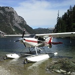
The guy that runs lodge there have a Beaver on floats. There is probably a strip there nearby, but I've never looked. Would make a good overnight stop after a good hot soaking!!
Jim
http://www.northstar-aero.com
Giving money and power to government is like giving whiskey and car keys to teenage boys.
http://www.northstar-aero.com
Giving money and power to government is like giving whiskey and car keys to teenage boys.
-
maules.com
- 100+ Posts
- Posts: 3144
- Joined: Tue Aug 29, 2006 4:01 pm
- Contact:
There is a strip at Liard but it is a few miles north on left side of road.
I used it once but too far from springs.
I used to land on the road just south of hot springs entry and park at the lodge and have also landed in gas pump forecourt, BUT, that was many years ago and probably not acceptable nowadays.
I used it once but too far from springs.
I used to land on the road just south of hot springs entry and park at the lodge and have also landed in gas pump forecourt, BUT, that was many years ago and probably not acceptable nowadays.
Who is online
Users browsing this forum: No registered users and 14 guests